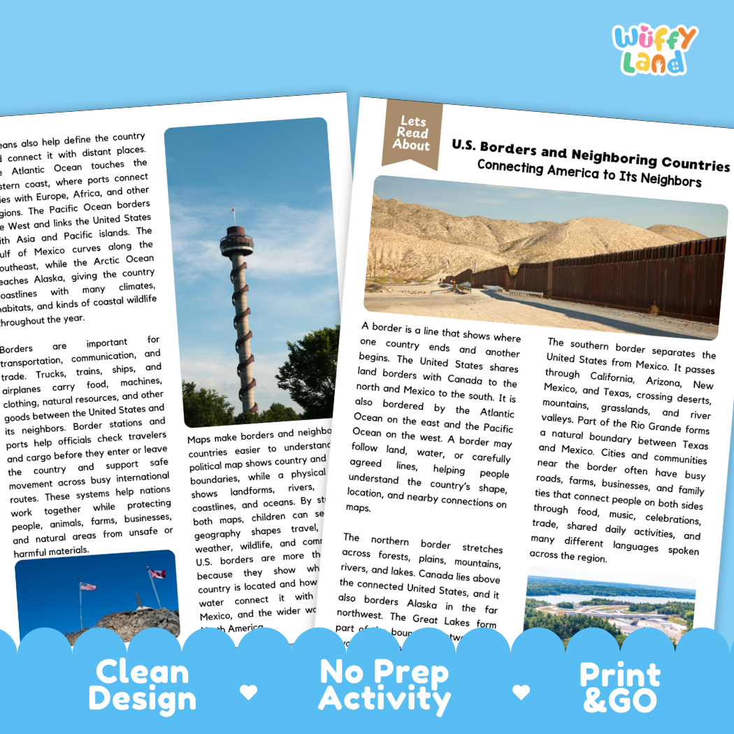
Help students explore political and physical geography, North American neighbors, international boundaries, cultural ties, and reading comprehension with this engaging, ready-to-print U.S. Borders and Neighboring Countries reading comprehension pack. This educational printable resource introduces young learners to the land and water borders that define the United States. Students will examine the meaning of national boundaries, explore the northern border shared with Canada across forests, plains, mountains, and the Great Lakes, investigate the southern border shared with Mexico through deserts, grasslands, and the natural boundary of the Rio Grande, and discover maritime borders along the Atlantic and Pacific oceans through an accessible informational text. Paired with text-dependent comprehension questions and a complete answer key, it makes integrating social studies, map skills, and literacy effortless for elementary and middle school classrooms.
About This Product
This printable learning activity offers a clear, visual exploration of how borders define a country's shape and connect it to neighboring nations and global waterways. Students will learn that a border is an agreed-upon line that shows where one country ends and another begins, often following physical landmarks like rivers and lakes or established lines of latitude and longitude on a map. The passage highlights the northern border stretching thousands of miles alongside Canada, traversing dense northern forests, rolling central plains, the Great Lakes waterway system, and extending to border the state of Alaska in the far northwest. Learners will explore the southern border separating the United States from Mexico across California, Arizona, New Mexico, and Texas, where the Rio Grande serves as a natural river border and where vibrant borderland communities share language, food, music, and commerce. The text also explains how the Atlantic Ocean on the east and the Pacific Ocean on the west serve as vast maritime boundaries that connect America to worldwide trade and transportation. Additionally, students will examine how border crossing stations monitor travel and trade to protect communities, and how both political and physical maps help geographers understand relationships between neighboring nations. Structured comprehension questions reinforce main ideas, context clues, domain vocabulary (such as "boundary"), and critical thinking skills.
Topics Included in This Pack
-
Connecting America to Its Neighbors: Defining national borders, boundary lines, and reading borders on political and physical maps.
-
The Northern Border with Canada: Exploring boundaries across the Great Lakes, northern plains, forests, mountains, and Alaska.
-
The Southern Border with Mexico: Discovering desert landscapes, the Rio Grande river boundary, and connected borderland cultures.
-
Oceans, Ports & Border Safety: Understanding the Atlantic and Pacific coastlines, international travel, trade, and border stations.
What is Included
-
Informational Reading Passage: Student-friendly reading sheets featuring crisp real-world photography of desert border vistas, lush northern river landscapes, and coastal lighthouses.
-
Comprehension Question Page: Structured short-answer questions designed to evaluate recall, vocabulary (such as "boundary"), and textual evidence.
-
Complete Answer Key: Teacher reference page for quick grading and classroom discussion.
-
Print-and-Go PDF: High-resolution digital file formatted for effortless classroom printing.
Perfect For
-
Social Studies & Reading Integration: Cross-curricular non-fiction reading during U.S. geography, North America studies, map skills, world cultures, or international relations lessons.
-
Independent Practice & Centers: Meaningful independent seatwork, morning work, or social studies literacy stations.
-
Sub Plans & Quick Review: Self-contained, hassle-free activity pack ready for substitute teachers.
-
Homeschool Lessons: Guided, straightforward reading and comprehension practice for home study.
Why Teachers & Parents Love It
-
Zero Prep Required: Simply print and hand out with no extra cutting or preparation needed.
-
Evidence-Based Questions: Guides students to refer directly back to the text to support their answers.
-
Clean Visual Design: High-contrast typography and clutter-free layouts that keep students focused.
Inspire curiosity about North American geography, international boundaries, and neighboring countries with this U.S. Borders and Neighboring Countries Reading Comprehension Passage and Questions Activity Pack today!