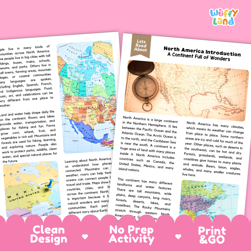
Help students explore continental geography, physical landforms, diverse biomes, climate zones, and reading comprehension with this engaging, ready-to-print North America Introduction reading comprehension pack. This educational printable resource introduces young learners to the vast continent situated in the Northern Hemisphere, flanked by the Pacific Ocean on the west, the Atlantic Ocean on the east, the Arctic Ocean to the north, and the Caribbean Sea to the south. Students will discover that North America encompasses diverse countries including Canada, the United States, Mexico, and neighboring island nations. Through an accessible informational text, students examine major physical landforms such as the towering Rocky Mountains, expansive Great Plains, deep canyons, dense forests, arid deserts, mighty river corridors, and the freshwater Great Lakes. The passage also highlights varied climate zones—from icy northern expanses to hot southwestern deserts—adapted wildlife (bears, bison, eagles, and whales), and dynamic cultural communities. Paired with text-dependent comprehension questions and a complete answer key, it makes integrating social studies, world geography, Earth science, and literacy effortless for elementary and middle school classrooms.
About This Product
This printable learning activity offers a clear, visual overview of the physical features, ecosystems, and human communities that shape North America. Students will learn what defines a continent—a massive continuous landmass containing diverse regions, nations, and cultures. The passage details how physical geography defines the landscape, highlighting the towering Rocky Mountains stretching across the west, expansive inland prairies, deep river canyons, and the Great Lakes holding immense freshwater reserves. Learners will investigate the continent's wide range of climates, discovering why northern regions experience long, freezing winters while arid regions in the southwest stay hot and dry. The text illustrates how varied biomes—from temperate forests and open grasslands to coastal wetlands and ocean waters—provide vital habitats for wildlife like brown bears, roaming bison, soaring eagles, and marine mammals. In addition, students examine human geography, discovering how major rivers, lakes, and oceans enable trade, farming, and settlement growth, and how studying continental maps reveals the connections between natural environments and the daily lives of people living across Canada, the United States, Mexico, and Caribbean communities. Structured comprehension questions reinforce main ideas, context clues, domain vocabulary (such as "continent"), and critical thinking skills.
Topics Included in This Pack
-
A Continent Full of Wonders: Locating North America in the Northern Hemisphere between the Pacific, Atlantic, and Arctic Oceans.
-
Major Nations & Territories: Introducing Canada, the United States, Mexico, and surrounding Caribbean island nations.
-
Physical Landforms & Waterways: Exploring the Rocky Mountains, Great Lakes, deep canyons, wide plains, and coastlines.
-
Diverse Climates & Wildlife: Comparing icy northern regions with arid deserts, and discovering native animals like bears, bison, eagles, and whales.
What is Included
-
Informational Reading Passage: Student-friendly reading sheets featuring vintage navigation compasses, historical parchment maps, and colorful modern regional maps of North America.
-
Comprehension Question Page: Structured short-answer questions designed to evaluate recall, vocabulary (such as "continent"), and textual evidence.
-
Complete Answer Key: Teacher reference page for quick grading and classroom discussion.
-
Print-and-Go PDF: High-resolution digital file formatted for effortless classroom printing.
Perfect For
-
Social Studies & Geography Integration: Introductory units on the seven continents, North American geography, world maps, biomes, or physical landforms.
-
Independent Practice & Centers: Meaningful independent seatwork, morning work, or social studies literacy stations.
-
Sub Plans & Quick Review: Self-contained, hassle-free activity pack ready for substitute teachers.
-
Homeschool Lessons: Guided, straightforward reading and comprehension practice for home study.
Why Teachers & Parents Love It
-
Zero Prep Required: Simply print and hand out with no extra cutting or preparation needed.
-
Evidence-Based Questions: Guides students to refer directly back to the text to support their answers.
-
Clean Visual Design: High-contrast typography and clutter-free layouts that keep students focused.
Inspire curiosity about continental geography, iconic natural wonders, and North American ecosystems with this North America Introduction Reading Comprehension Passage and Questions Activity Pack today!