
wuffyplayandlearn
Hungary Geography Coloring Poster and Activity Worksheet
Regular price
$1.00 USD
Regular price
$1.80 USD
Sale price
$1.00 USD
Quantity
Couldn't load pickup availability
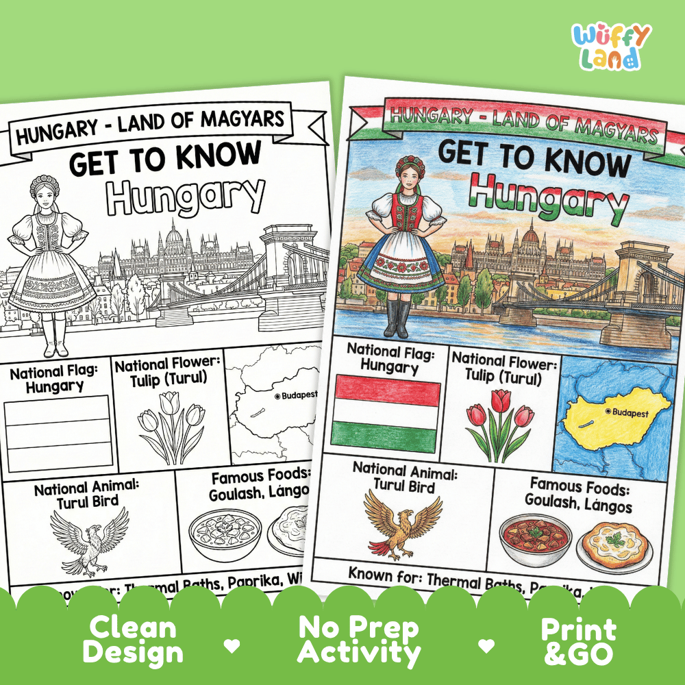
Bring world geography and cultural studies to life with this engaging Hungary Geography Coloring Poster! This printable social studies resource helps elementary students discover key facts and national symbols for Hungary through hands-on visual learning. It is classroom-ready and designed to make country research fun and accessible for young learners.
This printable geography resource introduces students to Hungary, known as the "Land of Magyars," through clear illustrations and essential facts. Students explore official national symbols, famous traditional foods, geography, and cultural highlights. Teachers can use the full-color version as an instructional poster or anchor chart, and the black-and-white version as an engaging coloring worksheet or interactive notebook page.
Country Nickname: Land of Magyars.
National Flag: Hungary official flag illustration.
National Flower: Tulip (Tulipán).
National Animal: Turul Bird.
Country Geography: Outline map highlighting the capital city of Budapest.
Famous Foods: Goulash and lángos.
Key Highlights: Thermal baths, paprika, and wine.
Full-Color Poster: Ready-to-display reference page featuring vibrant illustrations of Hungarian symbols and landmarks.
Black-and-White Coloring Worksheet: Clean, printable coloring page for hands-on student activity.
Country Studies: Supplemental material for world geography and European culture units.
Morning Work: Calm, educational coloring activity to start the school day.
Social Studies Centers: Independent station work or research activity.
Fast Finishers: Meaningful enrichment for students who complete assignments early.
Sub Plans: Easy, print-and-go activity requiring zero advance prep.
Zero Prep: Print and go with no extra cutting or assembly required.
Clean Design: High-quality line art and clear labeling keep students focused on key learning concepts.
Versatile Use: Works seamlessly as an informational classroom anchor chart or an interactive student coloring page.
View full details
About This Product
This printable geography resource introduces students to Hungary, known as the "Land of Magyars," through clear illustrations and essential facts. Students explore official national symbols, famous traditional foods, geography, and cultural highlights. Teachers can use the full-color version as an instructional poster or anchor chart, and the black-and-white version as an engaging coloring worksheet or interactive notebook page.
Topics Included in This Pack
What is Included
Perfect For
Why Teachers Love It
Help your students explore world cultures and social studies with this no-prep Hungary Geography Coloring Poster today!

-
Easy to Download
All you need to do is add this product to your chart and finish the payment, and you will get the pdf instanly! 😊
-
Print as Many Time as You Want
As long as not for sale, you are allowed to print it as much as you want! Use this for all of your children and have fun 🥰