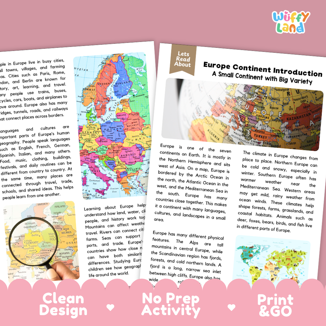
Help students explore world geography, European landforms, climates, cultures, and reading comprehension with this engaging, ready-to-print Europe Continent Introduction reading comprehension pack. This educational printable resource introduces young learners to the continent of Europe, including its geographical borders (the Arctic Ocean, Atlantic Ocean, and Mediterranean Sea), mountain ranges like the Alps, Scandinavian fjords, regional climates, rivers and trade routes, wildlife habitats, diverse languages, and historic cities through an accessible informational text. Paired with text-dependent comprehension questions and a complete answer key, it makes integrating social studies, physical geography, and literacy effortless for elementary and middle school classrooms.
About This Product
This printable learning activity offers a clear, visual exploration of Europe—a compact continent characterized by incredible physical variety, rich cultural heritage, and interconnected landscapes. Students will discover that Europe is located mostly in the Northern Hemisphere, situated west of Asia and bordered by major bodies of water including the Arctic Ocean to the north, the Atlantic Ocean to the west, and the Mediterranean Sea to the south. The passage introduces Europe's striking physical geography: the towering peaks of the Alps in central Europe, expansive rolling plains and grasslands, and the dramatic fjords of Scandinavia—long, narrow sea inlets nestled between steep cliffs. Learners will trace regional climate patterns, comparing the cold, snowy winters of northern Europe to the mild, rainy maritime weather of the west and the warm, sunny Mediterranean climate of the south. The text highlights how Europe's major rivers connect distant communities for trade and transportation, how varied habitats support diverse wildlife like deer, foxes, and bears, and how dozens of neighboring countries share close borders while preserving distinct languages, traditions, architecture, and foods. Structured comprehension questions reinforce main ideas, context clues, geography vocabulary (such as "fjord"), and critical thinking skills.
Topics Included in This Pack
-
A Small Continent with Big Variety: Locating Europe on world maps, exploring its borders, oceans, and closely neighboring nations.
-
Physical Landforms & Fjords: Discovering the Alps, coastal plains, inland rivers, and Scandinavian coastal fjords.
-
Regional Climates & Ecosystems: Comparing Mediterranean warmth, western maritime rains, snowy northern winters, and regional wildlife.
-
Cultures, Cities & River Trade: Exploring transportation along European waterways, modern rail networks, languages, and historic cultural landmarks.
What is Included
-
Informational Reading Passage: Student-friendly reading sheets featuring crisp full-color political maps, physical elevation maps of Europe, alpine landscapes, and coastal scenery.
-
Comprehension Question Page: Structured short-answer questions designed to evaluate recall, vocabulary (such as "fjord"), and textual evidence.
-
Complete Answer Key: Teacher reference page for quick grading and classroom discussion.
-
Print-and-Go PDF: High-resolution digital file formatted for effortless classroom printing.
Perfect For
-
Social Studies & Reading Integration: Cross-curricular non-fiction reading during seven continents units, world geography, landforms and bodies of water, world cultures, or map skills lessons.
-
Independent Practice & Centers: Meaningful independent seatwork, morning work, or social studies literacy stations.
-
Sub Plans & Quick Review: Self-contained, hassle-free activity pack ready for substitute teachers.
-
Homeschool Lessons: Guided, straightforward reading and comprehension practice for home study.
Why Teachers & Parents Love It
-
Zero Prep Required: Simply print and hand out with no extra cutting or preparation needed.
-
Evidence-Based Questions: Guides students to refer directly back to the text to support their answers.
-
Clean Visual Design: High-contrast typography and clutter-free layouts that keep students focused.
Inspire curiosity about world cultures, continental landforms, and global geography with this Europe Continent Introduction Reading Comprehension Passage and Questions Activity Pack today!