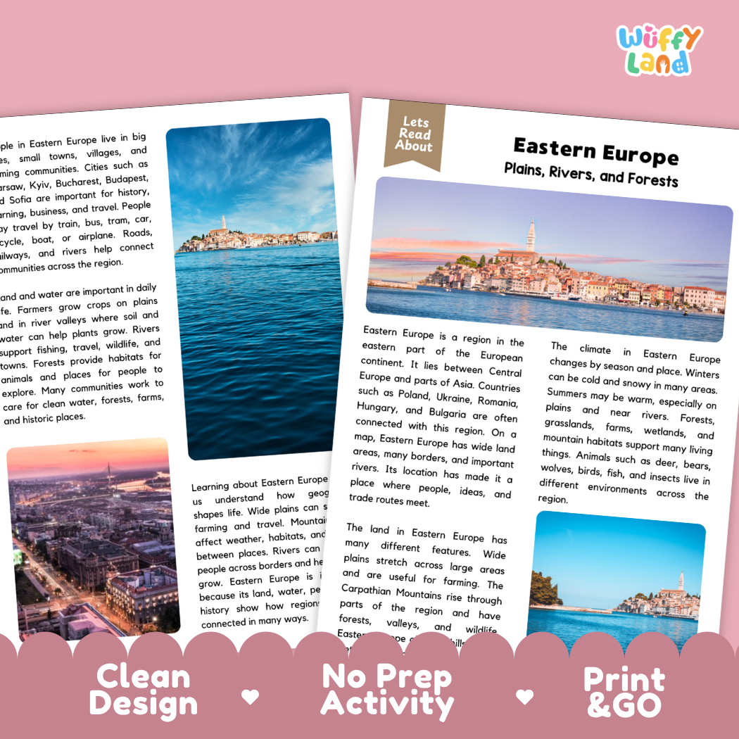
Help students explore European geography, continental landforms, regional climates, historic trade routes, and reading comprehension with this engaging, ready-to-print Eastern Europe reading comprehension pack. This educational printable resource introduces young learners to the geography of Eastern Europe, including bordering nations (such as Poland, Ukraine, Romania, Hungary, and Bulgaria), expansive agricultural plains, the Carpathian Mountains, major waterways like the Danube River, regional wildlife, seasonal continental climates, and historic capital cities through an accessible informational text. Paired with text-dependent comprehension questions and a complete answer key, it makes integrating world geography, social studies, and literacy effortless for elementary and middle school classrooms.
About This Product
This printable learning activity offers a clear, visual exploration of Eastern Europe—a vast and diverse region located between Central Europe and parts of Asia, known for its wide open landscapes, vital waterways, and rich cultural traditions. Students will discover that Eastern Europe has long served as a dynamic crossroads where people, ideas, and trade routes meet. The passage highlights the region's prominent physical features: the expansive flat plains and grasslands that provide rich soil for farming, dense ancient forests, tranquil wetlands, and the sweeping peaks of the Carpathian Mountains. Learners will examine seasonal weather patterns, discovering how cold, snowy winters give way to warm summers, especially across lowlands and fertile river valleys. The text explores the vital role of the Danube River—a major waterway winding through multiple countries that links towns, farms, and busy cities like Budapest—while detailing native wildlife such as brown bears, wolves, deer, birds, and fish. In addition, students will learn how modern highways, railways, and historic rivers connect communities across borders, supporting agriculture, daily life, and global trade. Structured comprehension questions reinforce main ideas, context clues, domain vocabulary (such as "plains"), and critical thinking skills.
Topics Included in This Pack
-
Plains, Rivers, and Forests: Locating Eastern Europe on world maps and understanding its role as a bridge between Central Europe and Asia.
-
The Carpathian Mountains & Fertile Lowlands: Discovering mountain forests, valleys, wetlands, and wide agricultural plains.
-
The Danube River & Water Trade Routes: Learning how major European rivers connect nations, supply water to farms, and support transportation.
-
Continental Climates & Wildlife: Comparing snowy winter seasons with warm summers, and exploring woodland habitats for deer, bears, and wolves.
What is Included
-
Informational Reading Passage: Student-friendly reading sheets featuring crisp real-world photography of historic riverside architecture, sweeping green plains, mountain valleys, and coastal waters.
-
Comprehension Question Page: Structured short-answer questions designed to evaluate recall, vocabulary (such as "plains"), and textual evidence.
-
Complete Answer Key: Teacher reference page for quick grading and classroom discussion.
-
Print-and-Go PDF: High-resolution digital file formatted for effortless classroom printing.
Perfect For
-
Social Studies & Reading Integration: Cross-curricular non-fiction reading during European geography, world continents, landforms and river systems, climates and ecosystems, or map skills lessons.
-
Independent Practice & Centers: Meaningful independent seatwork, morning work, or social studies literacy stations.
-
Sub Plans & Quick Review: Self-contained, hassle-free activity pack ready for substitute teachers.
-
Homeschool Lessons: Guided, straightforward reading and comprehension practice for home study.
Why Teachers & Parents Love It
-
Zero Prep Required: Simply print and hand out with no extra cutting or preparation needed.
-
Evidence-Based Questions: Guides students to refer directly back to the text to support their answers.
-
Clean Visual Design: High-contrast typography and clutter-free layouts that keep students focused.
Inspire curiosity about world landscapes, major rivers, and interconnected continental history with this Eastern Europe Reading Comprehension Passage and Questions Activity Pack today!